Navigation


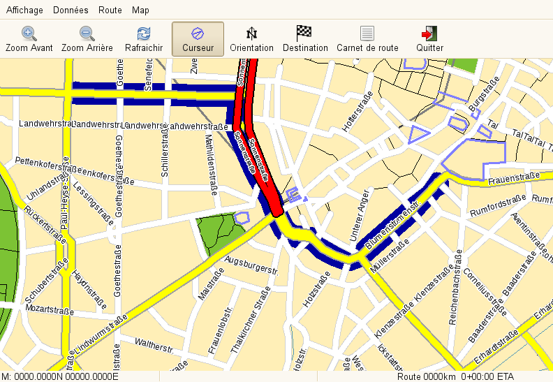
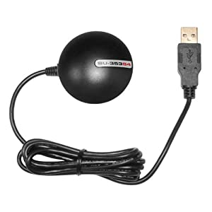
The goal of this project is to develop a built in navigation system that can be displayed through the infotainment interface. The navigation system will use the BU-353-S4 GPS receiver and will display the location of the car on a map provided by OpenStreetMap. The system will be run through Quantum GIS (QGIS). The navigation system will be able to search for locations and calculate the shortest route there.
We are aiming to create this project from scratch using open source resources. Developing our own navigation system will eventually allow for it to be customized for EVs. The most power-efficient routes could be calculated and charging stations could be included on the map. We are modelling our navigation system after NavIt, which is a pre-built, open source navigation system.
The navigation system is still being developed, and is currently limited by the processing power of our on-board computer. We are looking for ways to increase the efficiency of this system. This project should be completed by the time the car is ready to drive. Having GPS navigation is standard on vehicles today, and we are aiming to have the E-Volvo be as driver-friendly as modern cars.